Pocket City: AI Skill Turns Any Street into a Miniature 3D Town
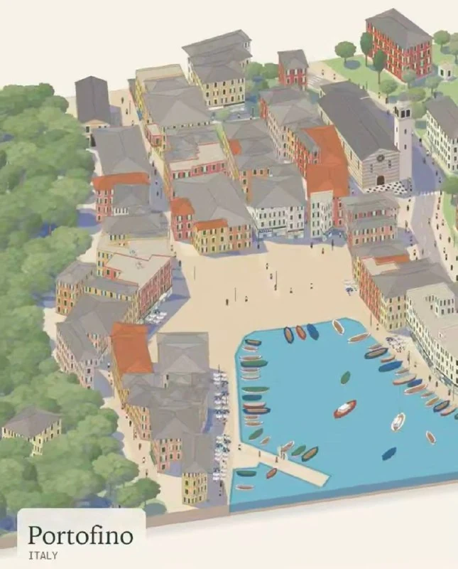
A new free AI skill called Pocket City uses OpenStreetMap data to generate stylized 3D dioramas of real locations and works in Claude and ChatGPT.
An enthusiast has created Pocket City, a free AI skill that turns any street into a miniature town.
The neural network takes data from OpenStreetMap and recreates real locations as stylized 3D dioramas that can be rotated and viewed from every angle.
During generation, the tool accounts for:
- local climate;
- seasons;
- major urban events.
The skill is free and works both in Claude and ChatGPT. It is available at april-zhu.com/pocketcity.
Why it matters
AnalysisPocket City shows how AI can combine open geospatial data with 3D visualization, turning ordinary streets into interactive models. This may be useful for cartographers, designers, educators, and rapid prototyping of urban scenes.
Discuss in community
Share your questions and insights with developers
Related in Ecosystem
Practical guides, core terminology, and agent skills
How AI Tools Built an Animated D&D Show
The team behind a YouTube D&D project used Midjourney, Seedream, Seedance 2.5, ElevenLabs, HeyGen, and Blender to create 77 Arcane-style animated inserts for the third episode.
LLM (Large Language Model)
A fundamental class of neural network architectures based on autoregressive transformers, predicting the probabilistic distribution of subsequent tokens and demonstrating emergent properties of abstract reasoning, code synthesis, and logical inference.
Enthusiast Built the Most Impressive AirDrop for Apple Vision Pro
Using GPT-6.2 Astra, ML-SHARP, and Tripo, a developer created a pinch-based interaction that lets users enter a photo on Apple Vision Pro.
15 Claude Cowork Skills Pack: ready-to-use skills for work and automation
A practical set of 15 ready-to-use Agent Skills for Claude Code and Cowork: site automation, contract review, invoice generation, and analytics.