OSINT experiment locates tree video from aircraft sound
An OSINT author identified the exact filming location and date of a random tree video using only aircraft sound, ADS-B data and a spectrogram.
A YouTube OSINT experiment shows how a random video of some trees can reveal its exact filming location and time using only the sound of passing aircraft.
The only inputs were:
- the video was shot somewhere in the United States;
- the filming date was 09/08/2026.
With only these data, the author eventually identified a specific pole in New York that had a street camera which recorded the video.
It is better to watch the video, but here is an explanation of how it was done.
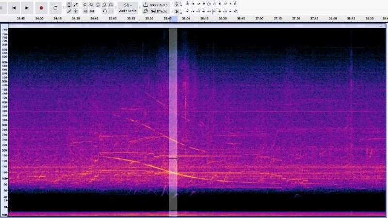
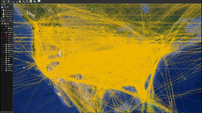
The image in the video gave nothing, so the author worked only with the audio. He opened the audio in a spectrogram and zoomed into the low frequencies. There he found two barely visible arcs: that is how a passing propeller aircraft sounds, when the tone first rises and then falls due to the Doppler effect. Between the arcs, 920 seconds passed. Then he downloaded ADS-B data — coordinates, altitude and time for every aircraft over the United States on that day — and filtered out all jet models.
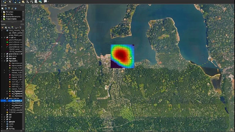
Next, he covered the area around the routes with a grid of points spaced 200 m apart. For each point, he calculated the second at which the closest approach of the aircraft would be heard there. Sound takes time to reach the ground, and the distance to the aircraft was computed along a straight line while accounting for the terrain below it. The shape of the arc gave two more clues: how strongly the tone drops indicates the aircraft's speed, and how quickly it drops indicates the distance to it. The final filter was silence: for 15 minutes between passes no aircraft should have flown overhead, which removed points near airports. After all filters, about 15,000 points remained.
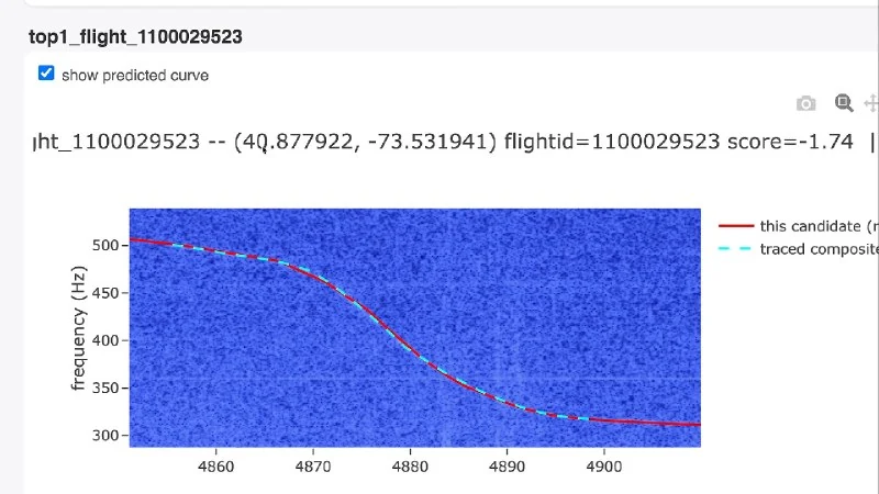
To choose one point, he used the fact that real arcs are uneven: an aircraft turns, accelerates and decelerates. For each point, using the actual trajectory of each flight, he modeled the arc a person would hear exactly there, correcting for sound delay. The model was overlaid on the spectrogram, and the score was how precisely it matched the real line. He did not fit the second arc; its position relative to the first is defined only by the trajectory. For this step, the grid was refined to 100 m.
One pair of flights scored much higher than the rest: the models almost perfectly matched both arcs. To verify, he took a third arc from the same recording — completely inaudible — and searched using only that arc and the recording time. The same point again took first place. He opened it in Google Street View on the shore in Oyster Bay, New York, and compared the tree silhouette with the frame: a tree shaped like the letter V, a pointed top and a round crown. Everything matched, and on a nearby pole hung the same surveillance camera.
I am confident that if Claude were given this video, it could easily repeat the result.
Why it matters
AnalysisThis case shows how open air-traffic data and acoustic analysis can turn incidental recordings into precise geolocation evidence. For privacy and security, it is a reminder that even videos without metadata can contain identifying signals.
Discuss in community
Share your questions and insights with developers
Related in Ecosystem
Practical guides, core terminology, and agent skills
Hermes Profile: OSINT Researcher & Deep Web Intelligence
Hermes open-source intelligence (OSINT) profile: multi-hop web investigation, primary source verification, competitive intelligence, and citation-backed synthesis.
5-Prompt Chain: Internet Verification and OSINT Investigations
A step-by-step 5-prompt OSINT methodology for online fact-checking and verification: scoping, email audits, username pivots, source corroboration, and report synthesis.
Sora and AI Video (Video Generation from Text)
A cutting-edge class of generative neural networks capable of creating photorealistic dynamic videos from text or static images (OpenAI Sora, Runway Gen-3, Kling, Luma Dream Machine).
Google releases Gemini Omni 1.2 Flash: videos with sound for up to 15 seconds
Google's updated Gemini Omni 1.2 Flash model generates and edits short videos with audio for up to 15 seconds, with 720p API pricing about 30% lower than 1.1 Flash.